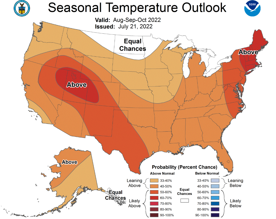
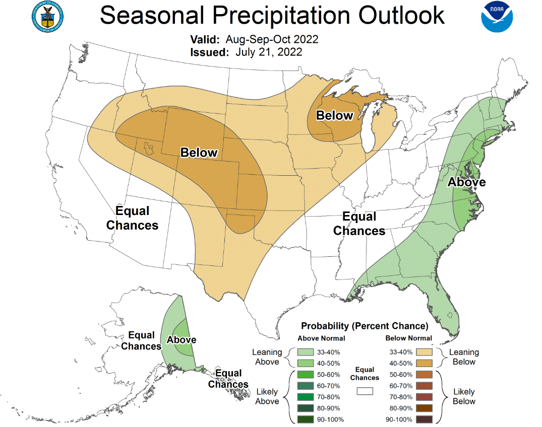
NWS: Hot, mostly dry finish to the growing season
The National Weather Service (NWS) 90-day forecast calls for elevated odds of above-normal temps across virtually the entire country for August through October. The highest chances for above-normal temps are expected to stay west of the main U.S. summer crop regions. Below-normal rainfall is expected over most of the central and western Corn Belt, with the greatest chances for lighter rainfall centered over the southwestern Corn Belt/Plains and a bubble over extreme northeastern Iowa, far eastern Minnesota and much of Wisconsin. NWS gives “equal chances” for normal, below- and above-normal precip over the far eastern/southeastern Corn Belt during the period.
If the forecast verifies, hotter-than-normal temps will necessitate timely late-season rainfall, especially in those areas that are expected to favor a drier bias. Based on this forecast, the key to the second half of the growing season will be whether there are enough extra bushels in the central and eastern Corn Belt to make up for likely yield losses in western and southwestern areas. The wild card could be weather over the next three months in the Southern Corn Belt and Ohio River valley.